


Select NOAA-NWS Forecast Office Text Products
(Product availability varies with seasons, forecast office, and weather.)
Forecast Discussion for Indianapolis, IN
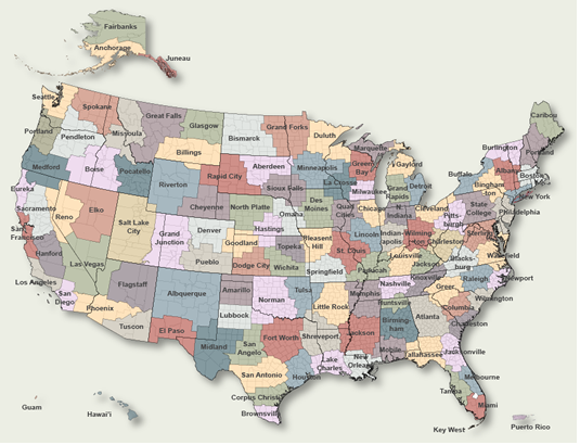
To Select Another NWS Office Click on Map or Choose from List
|
| Select Forecast Office: | Select Product: |
458 FXUS63 KIND 162348 AFDIND Area Forecast Discussion National Weather Service Indianapolis IN 748 PM EDT Thu Jul 16 2026 .KEY MESSAGES... - Hot and humid conditions expected again today, isolated showers and storms possible through this evening - Peak heat indices around 100 degrees each afternoon through Saturday - Greater chance for showers and storms Friday through the first half of the weekend, primarily during the afternoon and evening - Isolated strong to severe thunderstorms are possible Saturday PM, Damaging wind gusts are the primary threat && .DISCUSSION (This evening through Thursday)... Issued at 300 PM EDT Thu Jul 16 2026 This afternoon through tonight... Upper ridging and weak surface high pressure will continue to promote mostly quiet weather for much of the area. The stagnant suppressed airmass has kept hot-humid conditions in place with a Heat Advisory still in effect for north/northeast portions of central Indiana, including the Indianapolis metro, through 8PM EDT today. Isolated to scattered diurnal convection has developed across far southwestern counties where deeper moisture is located. Latest observations depict dewpoints well in the 70s in those areas. Slightly lower dewpoints further northeast along with weaker forcing has limited convective development, but isolated showers or a stray thunderstorm cannot be ruled out. Convection will likely dissipate shortly after sunset. Patchy Canadian wildfire smoke may slowly move into far north/northeast portions of the area as light winds turn more northerly into the evening. Friday through Saturday night... A more active pattern is expected with multiple disturbances moving through the region. The first disturbance will move in on Friday supporting higher rain chances. Modest ascent from the mid-upper level feature combined with daytime heating of a hot-humid airmass will promote numerous showers and thunderstorms. Severe weather is not expected, but efficient rainfall rates from warm rain processes could result in localized flooding, especially if any training occurs. Additional scattered convection can be expected late Saturday as another shortwave and associated cold front push through. Moderate to strong destabilization ahead of the approaching cold front late Saturday along with modest enhancement of mid-upper level flow could promote isolated severe thunderstorms, primarily across northern portions of central Indiana. Forecast soundings depict around 20-30 kt of effective shear, strong destabilization with steep low-level lapse rates, and DCAPE values as high as 1000 to 1400 J/KG which support the threat. The primary convective hazard is damaging wind gusts. Isolated large hail cannot be ruled out either, but the threat will quickly lessen as upscale growth occurs. The main timing appears to be from the mid afternoon through the early overnight hours. Sunday into next week... Long range guidance generally depicts upper ridging and weak surface high pressure building in Sunday behind the departing cold front. This will provide quiet weather with cooler-drier conditions. Guidance then suggest another shortwave approaches late Monday into Tuesday morning. Exact details remain uncertain with this disturbance due to diverging model solutions. It is worth noting guidance suggest more significant cold air advection with this disturbance which favors even cooler and drier conditions towards the middle of next week. && .AVIATION (00Z TAF Issuance)... Issued at 747 PM EDT Thu Jul 16 2026 - Isolated SHRA near KHUG/KBMG dissipating through 01Z...non-zero chances of brief MVFR VIS - Scattered/numerous -SHRA/TSRA Friday afternoon/early evening Discussion: VFR conditions are expected near central Indiana terminals this evening...ahead of visibility reductions in BR outside of KIND...and chances for MVFR/worse in scattered to numerous -SHRA/TSRA after 18Z Friday. MVFR/IFR at KLAF/KHUF/KBMG within 06Z-11Z Friday will likely be from VIS jumping through through levels...with the potential for more prolonged IFR/worse at KHUF per nearby heavy rainfall late Thursday. More numerous -SHRA and non-severe TSRA are expected after 18Z Friday, with occasional MVFR led by visibility reductions in heavier rain rates. Winds through the TAF period will range from light and variable tonight...to WSW/SW mid to late-day Friday sustained at 4- 7KT. && .IND WATCHES/WARNINGS/ADVISORIES... Heat Advisory until 8 PM EDT this evening for INZ021-029>031- 036>042-045>049. && $$ AVIATION...AGM DISCUSSION...Melo |
Previous Forecast Discussions may be found at
NWS Indianapolis, IN (IND) Office Forecast Discussions.
(Click 'Previous Version' there to view past versions successively.
Some may differ only in time posted.)
Products Courtesy of NOAA-NWS
NWS Information Parsing Script by Ken True at Saratoga Weather - WFO and Products Scripts by SE Lincoln Weather.
Mapping by Curly at Michiana Weather and by Tom at My Mishawaka Weather.