


Select NOAA-NWS Forecast Office Text Products
(Product availability varies with seasons, forecast office, and weather.)
Forecast Discussion for Indianapolis, IN
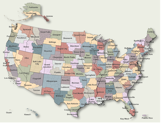
To Select Another NWS Office Click on Map or Choose from List
|
| Select Forecast Office: | Select Product: |
000 FXUS63 KIND 270713 AFDIND Area Forecast Discussion National Weather Service Indianapolis IN 313 AM EDT Sat Apr 27 2024 .KEY MESSAGES... - Partly Sunny and warm with chances for showers today. - Partly Cloudy and warm with chances for showers tonight. - Warm through much of the period, particularly Sunday, when record highs may be threatened. - Active weather, with multiple chances for showers and storms next week. && .SHORT TERM (Today and tonight)... Issued at 312 AM EDT Sat Apr 27 2024 Synopsis: Surface analysis early this morning shows strong high pressure over the east coast. Deep low pressure was found over IA and MN. This was resulting in a moderate pressure gradient across Central Indiana with southerly winds. Water vapor shows strong ridging in place over the Appalachians and deep low pressure was found over the Dakotas and Minnesota. A plume of tropical moisture was found between these two systems, streaming high moisture air across the Ohio Valley and Central Indiana. Radar mosaics show scattered showers and isolated thunderstorms through the Wabash valley and the southern Mississippi Valley. This was streaming north within the tropical plume. A very warm and moist air mass remained across Central Indiana with dew point temperatures in the middle 50s. Today... Little overall change is expected in the overall weather pattern today and tonight. Models depict the strong ridging aloft to remain east of Indiana. This will continue to steer any upper level disturbances within the SW flow mainly west of our state, across the middle Mississippi valley toward the western Great Lakes. Forecast soundings today show convective temperatures in the lower 70s with a column that appears quite moist. Pwats through the day remain around 1.3 inches but CAPE is limited and shallow. Still enough instability will be present for isolated showers and perhaps a thunderstorm to develop within the tropical air mass that will be in place. HRRR shows very isolated convection development through the day, with the best focus remaining over IL and the Wabash Valley. Again coverage appears to be very limited. Thus with our limited forcing expected today and only daytime heating to trigger showers, very low pops will be used to cover this possibility, and mainly during the afternoon hours with the best chances in place across the western parts of the forecast area. However many dry and warm hours will expected through the day. Given the ongoing warm air advection and warm air mass in place highs in the upper 70s and even near 80 will be possible today. Tonight... The predominate southwest flow aloft will remain in place overnight as the models suggest the upper low over the upper midwest to push a negatively tilted trough axis across IA toward WI. Much weaker and poorly defined upper support was shown across IL and Indiana within the warm and moist tropical flow. This is a low confidence signal. However again, the tropical plume of moist air will remain across the area tonight. Forecast soundings again show a nearly saturated column overnight with pwats again over 1.2 inches. Thus similar to the daytime hours, low chance pops will be needed, particularly across the western areas, but many dry hours overnight will be expected. Again with the warm and humid air mass in place across the area overnight lows in the lower to middle 60s will be expected. && .LONG TERM (Sunday through Friday)... Issued at 312 AM EDT Sat Apr 27 2024 Large scale troughing will dominate over much of the CONUS through the long term, largely centered over the central plains. Multiple waves will be moving through the trough, bringing multiple chances for showers and thunderstorms. As the region will sit under largely SW flow, along the leading edge of the trough, temperatures will be well above normal with highs through the week expected from near 70 to the mid 80s and lows ranging from the 50s to 60s. Sunday will be the warmest with highs up to the mid 80s, and while record temps are not in the forecast at the moment, it`s only a few degrees shy so still can`t rule out tying or breaking the daily record at Indy of 86 that day. The first wave of the long term period will bring precipitation late Sunday and should last through early Tuesday. A brief break in the active weather is then expected before the next wave brings precip Wednesday and then lasting through the end of the week. At this time it is still looking as though the potential for severe weather will stay off to our west, but can`t rule out that some favorable parameters for stronger storms could reach central Indiana at times from early to mid week. Models are still noisy for next week, especially from mid week, on so confidence remains low. && .AVIATION (06Z TAF Issuance)... Issued at 108 AM EDT Sat Apr 27 2024 Impacts: - LLWS overnight, until 12Z. - Showers expected through 08Z-09Z at LAF. - Isolated RA/TSRA possible through TAF period, low confidence overall through the period. Discussion: The TAF sites will remain within the warm sector through this period as strong ridging remains aloft over the east coast allowing a quick SW flow across Indiana. A quick moving short wave within this flow will push an area of showers across the LAF area through 09Z. Furthermore a strong LLJ is expected to push across northwest parts of Indiana through the night. Thus have used a tempo group for showers at LAf for the next 3 hours along with LLWS overnight. Minimal forcing is suggested to pass through the day on Saturday. HRRR suggests the development of isolated afternoon showers, but confidence in any of these striking a specific TAf site at specific time is low. Thus have used a VCSH window during max heating hours. && .IND WATCHES/WARNINGS/ADVISORIES... None. && $$ SHORT TERM...Puma LONG TERM...KF AVIATION...Puma |
Previous Forecast Discussions may be found at
NWS Indianapolis, IN (IND) Office Forecast Discussions.
(Click 'Previous Version' there to view past versions successively.
Some may differ only in time posted.)
Products Courtesy of NOAA-NWS
NWS Information Parsing Script by Ken True at Saratoga Weather - WFO and Products Scripts by SE Lincoln Weather.
Mapping by Curly at Michiana Weather and by Tom at My Mishawaka Weather.